

 The Satellite Launch
"Dear Iranians, your children have put the first indigenous satellite into orbit," said Iranian President Mahmoud Ahmadinejad in a television address. "With this launch the Islamic Republic of Iran has officially achieved a presence in space." In the face of world opposition and sanctions, Iran has joined a very exclusive club of those countries that have managed to orbit a satellite using their own launch vehicle. On Feb 2, 2009 around 1835 UTC Iran became the 11th country, to put a satellite named Omid (Hope) (Norad ID 33506) into orbit using the indigenously built launch vehicle Safir-2. The event appeared to be timed to coincide with the 30th anniversary of the Iranian Revolution. The Iranian aerospace achievement comes as the country has been subject to sanctions for nearly 30 years. Iran as a nation can rightly feel proud of their historical achievement.
Both the United States and Russia confirmed tracking orbital elements of the Iranian spacecraft the following day. USA, UK and France expressed immediate concerns that the technology could be used to develop intercontinental ballistic missiles. Many in the west are comparing it to 1957 Soviet Unions Sputnik launch which signaled surprisingly rapid technological progress that eventuality translated into a greater military success. "I take my hat off to the Iranian scientists. ... They have shown their missiles can reach any point on the globe," Interfax quoted RKK Energia head Vitali Lapota. The critical lesson from February launch is that Iran is beginning to master the science of staging rockets to deliver larger payloads to higher orbits. On March 19, 2009 Iran announced that Omid has completed most of its mission and will remain in orbit for another 38 days before re-entering the earth’s atmosphere.
Launch Vehicle
Over a decade ago Iran was reported to develop a launch vehicle named IRIS based on Shahab-3. The Shahab-3 is a liquid fuelled (kerosene and nitric acid) single stage missile, an improved variant of Nodong-1/Scud-C vehicle. The Iran Space Research Center started testing launch capabilities with the Kavoshgar series sounding rockets since early 2007 reaching 150 -200 km altitude. These rockets were based on Shahab-3 series and were typically equipped with wind, air and temperature instruments. In 2008 Iran announced the development of a two stage launch vehicle Safir-1 which was claimed to have launched a dummy satellite in August. The main launch site is thought to be at Emamshahr, located at 36 deg 25 min latitude north and 55 deg 01 min east.
Iran’s technological breakthrough is the two stage (or may be three stage) Safir-2 launch vehicle which is a source of concern in the West. Iran has released few details on the rocket leaving the outsiders to guess at its capabilities. According to Iran Space Agency Safir-2 weighs 26 tons, and is 22 m length, 1.25 m diameter. Based on the technical information available on the different variants of the two-stage Scud using kerosene and nitric acid Safir-2 would not reach the orbital speed (7.7 km/sec) required for Omit’s orbit. Claims that Iran had used a solid-based third stage to launch the satellite were rejected when the amateur satellite observers reported tracking the second stage. The short faring ruled out the possibility of a spring type mechanical assist module. David Wright of the Union of Concerned Scientists (http://www.ucsusa.org) in Cambridge, Massachusetts in his analysis suggests the use of N2O4/UDMH as propellants, similar to that used by the China’s Long March Booster. The real advancement of Safir-2 lies in its second stage; the light weight composite design, clam shell fairings and launch ready storable liquid propellants – a significant advancement for military missiles. By using advanced fuel or lighter structures, if Safir-2 launched the satellite in two stages then Iran has gone beyond Scud technology and has leapfrogged the North Koreans in their mastery of missile technology. The April 5, 2009 North Korean launch failure confirms the Iranian superiority when the three-stage Taepodong-2 from vehicle failed to deliver a satellite to orbit.

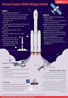
Launch Vehicle Safir-2
(Check www.youtube.com for launch videos)Satellites
Omid
The 27 kg Omid was launched in an elliptical orbit of perigee radius of 242 km and an apogee radius of 322 km at an inclination of 55 deg, circles the earth every 90-100 minutes, and transmits data on two frequency bands (prior to launch Iran registered 465 MHz as a downlink frequency and 401 MHz as command uplink) via its eight antennas. Satellite is equipped with command processing, GIS, telemetry, remote sensing and GPS instruments.

Omid is a 0.4 m cube
Sinah-1 (Norad ID 28893)
Earlier on October 27, 2005, Iran met a key aerospace objective by becoming the 43rd nation to own and operate a satellite. Sinah-1 is still operational and provides non-military grade imagery from two remote sensing cameras. The Sinah-1 spacecraft was built with the help of Russia’s Polyot Co for $15 million and entered orbit onboard a Russian Kosmos-3M launch vehicle. The satellite weighed 160 kg and was inserted in the Sun Synchronous orbit (perigee 689.6 km, apogee 710.6 km, inclination 98.2 deg) giving it a global coverage. It carries earth monitoring experimental payload which monitor agriculture, natural resources and disasters for Iran. Tehran initially planned to construct the satellite, but its manufacturer, the Iranian Institute of Applied Research, experienced technical difficulties and requested Russian assistance.
Sinah-1
Mesbah
On Feb 19, 2003, Iran and Italy signed an agreement to build and launch the Mesbah satellite. The project was to be undertaken through collaborations between Iran’s Ministry of Science, Research and Technology and Italy’s Carlo Gavazzi Space company and is estimated to have already cost $11.3 million. Iranian and Italian scientists were to work together to produce, test and launch the satellite. Under the agreement, Iranian scientists were to also be trained by experts from Carlo Gavazzi Space. The Iran Telecommunications Research Center (ITRC) and the Iran Science Organization of Science and Technology (IROST) are jointly building this micro-satellite with the Italian company. The satellite was the first Iranian satellite project to include indigenous technology and was heralded by the Iranian science minister as a new “era of producing and developing technology.” This satellite weighs 75 kg and has an expected lifetime of three years. One model tested included a gravity gradient controlled 700 x 500 x 500 mm unit a UHF payload transceiver with 35W average usage. Mesbah is a low earth orbit (LEO) civilian telecommunications satellite which will service about 1000 ground terminals, including mobile tracking system, fleet monitoring and metering station monitoring etc.
Originally scheduled for launch at the same time as the Sinah-1, the Mesbah’s deployment has been delayed and, as of February 2009 it was unclear when, or whether, the satellite would be launched. Once operational, personnel from ITRC/IROST will control it from a ground station in Tehran throughout its three-year lifespan.
SMSS
On April 12, 1998 a Memorandum of Understanding (MOU) was signed by China, Iran, South Korea, Mongolia, Pakistan and Thailand to build a joint Small Multi-Mission Satellite (SMMS). A project of the Asia-Pacific Multilateral Cooperation in Space Technology and Applications, the SMMS was a joint effort to develop a satellite for environmental monitoring and disaster management. This remote-sensing system was planned to be equipped with two, charge-coupled device cameras capable of 30-meter resolution, as well as a hyper-spectral imager. The satellite’s launch was initially anticipated for 2004, but delays pushed back the intended launch year to sometime in 2007, at the earliest. China, Iran and Thailand launched a satellite in 2008 with the same goal of monitoring and preparing for natural disasters, but it was unclear whether or not the satellite launched was the SMMS.
Zohreh
Iran has been planning the GEO communications satellite Zohreh since the 1970s. Zoreh has been the most troubled satellite project of Iran with many international agreements and cancellations. In 1993 Iran reached a tentative agreement to build two 1850 kg satellites with the Aerospatiale using the Alcatel Escape communication payload for a 10 year design lifetime. The 12 transponder satellite would have both the Ku-band and L-band links. It was suppose to occupy one of the three internationally allocated slots in the geosynchronous orbit reserved for Iran. Agreements could not be completed, due to technology transfer provisions through which US blocked countries to respond to Iran’s tender request.
On Jan 31, 2005 Russia and Iran signed another deal to continue with the Zohreh satellite project. An earlier deal for the same satellite with Russia was cancelled in Feb 2003 under US pressure. The deal was signed between the chairman of the Board of Directors of Iran Telecommunication Company and two Russian directors from Russia’s Federal Space Agency, Rosaviakosmos and Aviaexport. The $132 million agreement included the design, consultation, testing and the launch costs of the satellite system.
Iranian Space Organizations
The Iranian National Space Agency was established in April 2003, to apply space sciences and technology for economical, cultural and scientific development of the country. Three decades ago Iran launched the Iran Remote Space Sensing Center (IRSC), which was affiliated to the Ministry of Post and Telegraph and Technology. This veteran unit coordinates ground image distribution activities and geological and mineral studies.
The Iranian Space Research Center (ISRC) was built in an uninhabited desert area in Semnan Province, south-east of Tehran. The Center has a remote satellite command-and-control facility and a satellite launch pad. The agency has ground stations that can receive data from a number of the current and future satellites. The Aerospace Research Institute (ARI) affiliated to the Ministry of Science, Research and Technology is another active organization in the space science and technology applications that follows different space related studies and activities. The Islamic Republic of Iran Meteorological Organization (IRIMO) performs meteorological studies and atmosphere analysis in support of agriculture, transportation, water, energy, environment and related sectors. In addition to technical programs, at least seven Iranian Universities offer higher education and research in aerospace engineering.
The Islamic Republic Broadcast Organization rents its own transponders on the Intelsat, which is positioned on longitude 63 east. The organization also uses Eutelsat, HotBird-3, and Telstar satellite services. In addition, the communications station in Tehran via the Inmarsat satellite is designed mainly for communication with ships at sea. Iran employs satellite channels for contact with ships and mobile ground stations.


0 Comments